
Essential Victorian High Country 4WD Camping Guide
The Victorian High Country covers a large part of South-Eastern Victoria, with much of the area only accessible via a 4WD. It is truly one of the premier camping and 4WDing destinations in Australia with a huge range of tracks and campsites on offer, the majority of which are completely
free of charge.
There’s a range of great local towns to visit, shops and pubs to experience, and of course, the spectacular mountain scenery that the Victorian High Country is famous for.

Being such a large area you can spend weeks or even months exploring this region.
In this article, we focus on some of the southern areas of the Victorian High Country. Keep an eye on future articles to explore more of the region.
There will be some places that you may have heard of before, and maybe a few spots that are new. One aspect of the Victorian High Country is that it has many spectacular places only known to a relative few, and hopefully, this article will encourage you to explore some of these hidden gems (or perhaps find your own piece of Victorian High Country paradise!).
Best Camper For The Victorian High County
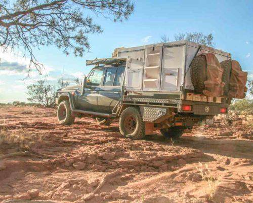
The Victorian High Country is truly Trayon territory, as many of the tracks are unsuitable for camper trailers, and having the freedom of a slide on camper is a distinct advantage. There is nothing better than rocking up to one of the region’s pristine campsites with all the comforts of home that you have in the Trayon.

Check out this Victorian High Country Map of our adventure.
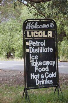
Start of Trip – Licola Victorian High Country
We’ll start this adventure at Licola, which is a small town on the banks of the Macalister River.
Licola has an excellent general store for any of those last minute supplies or fuel for the trip. The photographs in the store feature some great pictures of previous traveler’s dilemmas, as well as photographs of the dramatic weather conditions such as floods and fires. The shady park nearby is an excellent place for a cuppa or lunch before tackling the tracks.

From Licola, head along the Wellington River Valley on the Tamboritha Road which passes several picturesque camping areas on the riverbank – this is a great option for an overnight stop.
Wellington River Campgrouds – Victorian High Country
The Wellington River Camping area consists of 14 separate camping areas of varying sizes along a 10km stretch of the Wellington River. Outside of the really busy periods of the year such as Easter and summer long weekends, you are usually assured of getting a suitable site to set up camp.
Wood sometimes can be scarce so it pays to bring your own or collect some on the way to ensure a good campfire for the evening. The Wellington River is also a good place to try your luck at catching a Trout – although probably having a plan B for when the fish aren’t hungry!
More details on the camping along the Wellington River and further in the Alpine National Park can be found on the Parks Victoria Website.

From the Wellington River, the road climbs up out of the valley to Bennison Lookout which is worth a stop to take in the fabulous views towards Lake Tali Karng, Mount Wellington and the Razorback.
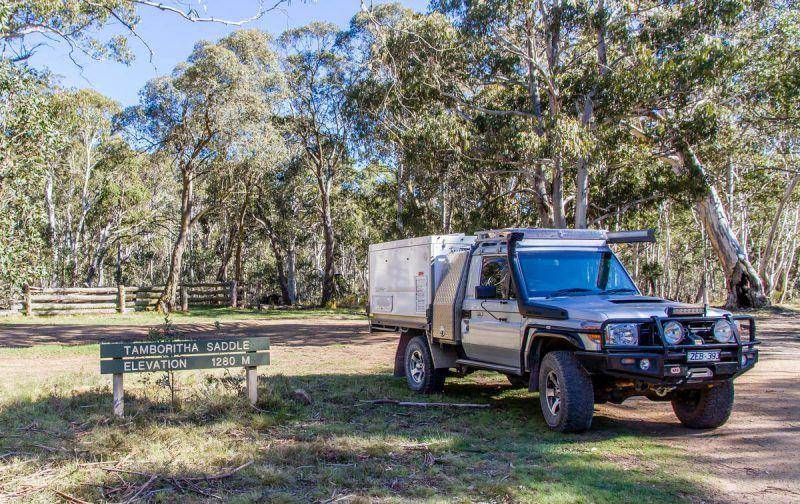
Next is Tamboritha Saddle and some of the fabulous Victorian high plains.
Continuing along the high plains on Tamboritha Road, head pass the Lost Plain picnic area and you eventually arrive at Arbuckle Junction. This is decision time – left is Howitt Road which heads towards the Howitt High Plains and right is the Moroka Road which heads towards the Pinnacles
and the east.
This trip we’ll explore east, so right it is along the Moroka Road.
The Moroka road offers great views at times to the north across the Avon Wilderness area with the mountain ranges in the distance. About 12km from Arbuckle Junction is MacFarlane Saddle which is the commencement point for the Lake Tali Karng walking track.
This is a popular walk across the high plains with a steep descent to the picturesque Lake Tali Karng, one of Victoria’s deepest natural lakes.
A further 13km onwards the road crosses Moroka River with the Old Moroka road on the right.
Another 2km is the Marathon Road turnoff on the right, which heads south to Briagolong.
The Moroka road now becomes the Pinnacles road and the next point of interest is Horseyard Flat, approximately 2km from Marathon Road. Horseyard flat is a series of grassy flats beside the Upper Moroka River and is a great spot to camp. There are pit toilets, a hut and several separate areas to setup camp.
Horseyard flat is also the starting point for the walking track down to Moroka Gorge and waterfall.
From Horseyard Flat it is another 8km to the turnoff to Billy Goats Bluff track (which we’ll check out later) then another kilometre to the fabulous Pinnacles.
Pinnacles Lookout and Fire Tower
From the Pinnacles carpark it is a short walk up the access track to the radio transmitter and fire spotters hut, then a steep track with sheer drops on both sides to the fire tower. The views are absolutely breathtaking – the panoramic 360 degree views from the Pinnacles take in the seemingly
endless mountains and valleys to the North and the plains all the way to the sea to the South (on a clear day). There’s information boards highlighting the surrounding areas and peaks, and your camera is sure to get a workout, especially on a good day.
This is one of my favorite views in all ofthe Victorian High Country.

From the Pinnacles head back down to Billy Goats Bluff turnoff on the right. Now is a good time to air down and prepare for some challenging 4WDriving.
Billy Goats Bluff 4WD Track – Victorian High Country
Billy Goat Bluff is one of the most iconic Victorian High Country tracks and considered one of the best of the Victorian High Country 4WD tracks. The track is very steep (drops 1200m in less than 7km) and challenging, with rock steps and loose sections requiring prudent line selection and plenty of clearance. The track can be quite narrow in places and it can be challenging to pass oncoming vehicles so put your UHF radio to scan and keep a close watch for vehicles.
This track is doable with a camper trailer but having a lightweight slide on like the Trayon makes the experience easier and safer without sacrificing any of the camping essentials we like to have in the bush nowadays.
There are some great photo opportunities all the way along the track, particularly at “the pinch” and the helipad.

At the bottom of Billy Goat Bluff track is the Wonnangatta Road. Turning left will take you through to Eaglevale and onto the iconic Wonnanngatta Station, but on this trek we’re turning right towards Dargo.
Around 6km onwards is Kingswell Bridge and immediately over the bridge turn to the left onto the Crooked River Track.

Crooked River Track – Victorian High Country
The Crooked River Track heads north through farmland and then into forested areas. There are a few deep river crossings that are generally straightforward with a firm base, however take particular
caution especially if recent rains have fallen. The track eventually comes to a large open grassy area called Talbotville, a very picturesque and terrific place to camp.

Old Gold Mining Town – Talbotville – Victorian High Country
A mountain gold town which flourished during Victoria’s golden era, Talbotville was one of the longest surviving towns in the region. Located on an open grassy flat on a bend in the Crooked River, the 1860s presented a scene of weatherboard stores and dwellings with the township servicing the local miners and rural families. Businesses included a butcher, baker, chemist, restaurant and a hotel, with a Post Office operating intermittently into the late 1940s. Today a sense of this history can be found in the old ruins, mine workings and the old cemetery.

The Talbotville camping area has pit toilets, fire rings and plenty of space to camp. It can get very busy during holidays so perhaps avoid peak times. There are plenty of 4WD and walking tracks emanating from here so it is a good place to base yourself for a few days and explore the area
further.
From Talbotville take the McMillan Road up to Grant which is approximately 11km. The Grant Township once had a population of around 2000 with stores, hotels, a police station, churches, banks, dwellings and even a local newspaper flanking two broad main streets. However little
remains today. There are some information boards and walking tracks around the township which provide an insight into the town’s former glory. From Grant head 6km to the Dargo High Plains Road then turn right toward Dargo which is a further 17km away.
Victorian High Country Central – Dargo
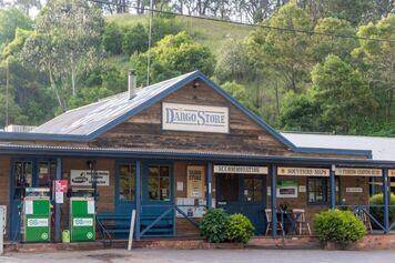
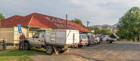
Dargo is arguably the hub of the Victorian High Country. There is plenty to see here including grabbing some last minute supplies, souvenirs or fuel from the general store. A fantastic option when passing through is to enjoy a meal at the legendary Dargo Pub. The Dargo Pub has a great ambience and is a terrific place to enjoy a cool beverage and grab a meal, while taking in the various photographs and information on offer inside. Camping is available out the back of the pub or over at the Dargo River Inn if wishing to make a night of it!
From Dargo take the road north on the Dargo High Plains Road through picturesque farmland and past charming homesteads, until climbing out of the valley into a forested area. About 6km from Dargo take the Upper Dargo Road which heads off on the right.
Further along this road there are some great camping areas on the Dargo River with places such as Italian Flat, Dusty Flat and Black Flat just to name a few. These areas have pit toilets and large flat grassy areas to setup camp.
Dargo High Plains Road – Victorian High Country
From the Dargo River campsites backtrack to the Dargo High Plains Road and commence the steep climb up onto the high plains. Around 11km further on is Grant Junction and the turn-off to Grant and Talbotville. From Grant Junction continue northwards through the forested area on the Dargo High Plains Road.
Past the Treasures-Mt Even Hut which is just visible from the main road with the Downey Road heading off to the right. Keep following the Dargo High Plains Road to the Treasure Plain.
Just past the Treasure’s boundary on Lankey Plain is the well-signed track on the right to King Spur and Mayford – our ultimate destination for the night. Turn right off the Dargo High Plains Road and start your journey along King Spur Track.
It will generally take about 1 hour to reach the camping areas in the valley from the turnoff on the Dargo High Plains Road.
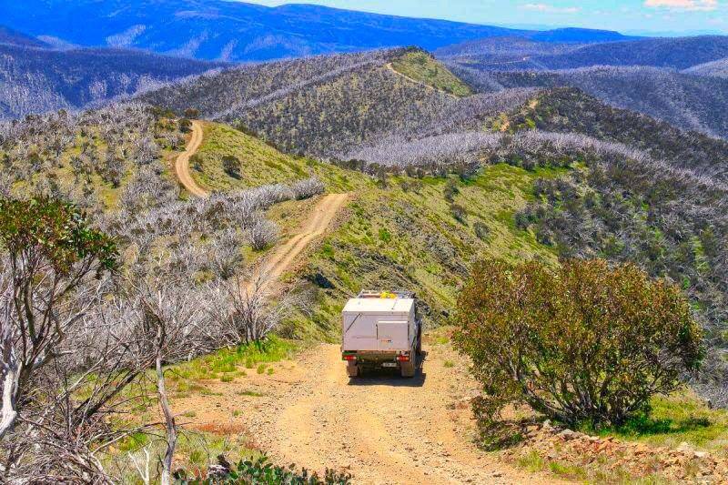
The King Spur Track starts by meandering amongst the Snow Gums before opening out to spectacular views across to Mt Hotham and Dinner Plain. There are several good camping areas on the cliff-edge but at an elevation of 1500m a cold night is guaranteed and a roaring fire essential
if choosing to camp here.
After a few kilometers there is a turnoff to the right to Long Spur Track – continue following King Spur Track. Next up are a series of rocky sections that are quite slow but generally fairly easy going. A little further and we commence the steep descent into the valley.
Now it’s time to select low range to save the brakes and tackle the several switch-backs which are a common feature of steep tracks in the victorian high country. The steep descent should pose few problems except in wet conditions when some of the clay based sections will become quite slippery.
At the end of the descent the reward is our first camping option beside the picturesque Dargo River. There is also a track to the right to another campsite, but it pays to cross the Dargo River and continue up the valley as there is plenty more to come.
Generally this first river crossing is fairly easy but there are several large rocks to avoid. If unsure it pays to walk the crossing first.
The track climbs steeply out of the river and then drops down to another crossing, with another two river crossings before the valley opens up into a picturesque grassy plain – with the bubbling Dargo River, surrounding mountains, and wide open plain this makes a spectacular sight! Be cautious
travelling at the beginning of the plain as there are several bog holes that can trap the unwary.
There are bypass tracks around the worst areas so generally these shouldn’t cause any problems.

Picturesque Valley – Mayford – Victorian High Country
Once on the grassy plain you have reached the locality of Mayford, one of the best places to camp in the Victorian High Country. With ample flat grassy campsites adjacent the Dargo River, plenty of shade from the majestic gum trees, and the vista of the surrounding mountains you would be hard pressed to find a better location for a few days.

After a pleasant night or even a few days at Mayford, it is time to backtrack down the valley and back up to the Dargo High Plains. However once back on the high plains road there is a location that should not be missed – the famous Blue Rag Range and trig point.
Top of the World – Blue Rag Trig Point
From the King Spur Track turn right onto the Dargo High Plains Road and drive 6km to the Blue Rag Track which commences on the left beside a small dam. Note that it is not advisable to tow a camper trailer up this track so leave your trailer at the Dargo High Plains Road – no issues with a
lightweight slide on camper like the Trayon with the advantage of having all the equipment right with you when we get the top.
The track climbs steeply from the road and then you are presented with the magical view of the track snaking its way along the mountain spur line into the distance with trig point just visible in the distance. This is one reason why this track is known as one of the most spectacular tracks in the victorian high country – the views and vistas are truly outstanding. Continue along the track to the trig point – at 1716m this point offers spectacular 360degree views across the mountains and valleys. Take some time to absorb this view and appreciate what many believe is the best view in the whole Victorian High Country!

Returning from the trig point you can backtrack to the Dargo High Plains Road, or take the Basalt Knob Track particularly if you are heading back towards Talbotville and are looking for a challenge!
The Victorian High Country (VHC) has some of the best 4WDriving and camping anywhere in Australia, and this trip is into one of the best in the region. With pristine camping, spectacular views, and great 4WDriving you just have to get out and explore this area for yourself.
With a slide on camper such as the Trayon which is the perfect companion for a victorian high country trip this will be a trip to remember. Book your holidays, sit down with a Victorian High Country Map to plan your route, pack up the 4WD and come to the Victorian High Country for a trip of a lifetime!
By Geoff Martin